
A silent census beneath the waves
A Canadian-led fleet of autonomous robots has quietly mapped the ocean’s invisible life, revealing a staggering cache of phytoplankton biomass. By drifting through the water column where satellites fall short, these instruments uncovered a hidden reservoir equal to the weight of about 250 million elephants. The result reframes how we measure ocean carbon and how we imagine the planet’s living blue engine.
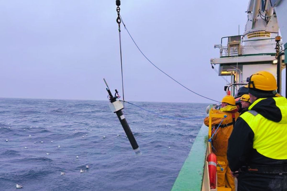
What the floats actually measured
The network, known as BGC-Argo, is a constellation of free-drifting floats that profile from the surface to the deep ocean. Each unit records light, chlorophyll fluorescence, and optical backscatter, turning subtle signals into estimates of phytoplankton carbon. Over time, more than 100,000 vertical profiles have stitched together a global, depth-aware picture of marine biomass.
These autonomous platforms excel where satellites cannot, operating under clouds, ice, and storms in light-limited depths. By resolving biomass beneath the surface, they capture the “missing” phytoplankton that space-based sensors systematically overlook.
The magnitude of a hidden giant
Phytoplankton are microscopic organisms, yet they feed marine food webs and regulate planetary climate. The team’s estimate—around 314 teragrams of phytoplankton biomass—translates to roughly 346 million tons, or the weight of 250 million elephants. That scale highlights how much living carbon is tucked below the ocean’s shimmering skin.
These organisms produce about half our breathable oxygen and draw down atmospheric CO2, stabilizing Earth’s chemistry. Their abundance and distribution steer fisheries, coastal ecosystems, and the long arc of ocean health.
Why satellites fall short
Space-based instruments infer phytoplankton from ocean color, which primarily samples the sunlit surface. Yet many blooms thrive at depth, at the “deep chlorophyll maximum,” where light is dim but nutrients are available. Satellites also struggle beneath persistent clouds, sea ice, and near complex coastal waters.
BGC-Argo closes these gaps by sampling day and night across clear and turbid seas. The result is a sharper, depth-resolved picture that complements and calibrates space-based observations.
How robots changed the game
Each float descends and ascends on a schedule, logging temperature, salinity, chlorophyll, and optical signals linked to phytoplankton carbon. By merging records across basins and seasons, scientists track when blooms start, peak, and fade—and how they react to heatwaves, storms, and shifting currents.
Equally vital is long-term continuity, with standardized measurements that expose subtle climate trends. That steadiness turns snapshots into time series, revealing patterns hidden by natural variability.
Key numbers at a glance
- About 314 teragrams of global phytoplankton biomass—roughly 346 million tons.
- Equivalent to the weight of 250 million elephants beneath the ocean’s surface.
- More than 100,000 vertical profiles collected across global oceans.
- Significant biomass lies beyond satellite reach, especially at depth and under ice.
Climate stakes and policy relevance
Better biomass estimates sharpen models of ocean uptake and atmospheric feedbacks. With improved constraints, projections of warming, oxygen loss, and productivity shifts become more reliable. That clarity matters for fisheries, carbon accounting, and ecosystem protection.
Depth-aware data also inform debates over ocean geoengineering, including iron fertilization schemes. Without robust baselines and regional context, interventions risk unintended ripple effects through food webs and biogeochemical cycles.
What scientists are saying
“As we refine our view beneath the surface, we’re uncovering a far larger, more dynamic reservoir of living carbon than satellites suggested,” said one lead researcher on the analysis. “Any future intervention must be judged against this richer, depth-resolved reality.”
From data fusion to real-time maps
The next step is to expand the fleet, improve sensor calibration, and fuse float records with satellite imagery and ship-based surveys. Machine-learning pipelines will merge these streams into near-real-time biomass maps, enabling earlier warnings for harmful algal blooms and ecosystem stress.
As more floats patrol polar and remote seas, the global picture will grow clearer and more actionable. The vision is a sustained planetary observatory for ocean health, one that keeps pace with a rapidly changing climate.
A reframed ocean narrative
The Canadian-led network reveals that the ocean’s tiniest drifters collectively weigh as much as a continent of megafauna. By peering beyond the surface sheen, science can finally balance the books of blue carbon with unprecedented precision. In an era of accelerating change, these quiet robots are giving the ocean its long-overdue, depth-aware voice.